Walkability refers to qualities that promote pedestrian activities in an area and is an essential aspect of shaping sustainable and liveable communities. Walkable environments may offer several benefits, such as reduced traffic, improved public health, and increased well-being. Multiple factors influence walkability, including the quality of pedestrian infrastructure, proximity to amenities, safety, and aesthetics. Depending on pedestrians’ individual preferences and trip purpose, these factors may be emphasized differently.
We have developed web and mobile applications for spatial walkability assessment as part of our Smart Plan and Twin Fjord projects. The prototypes cater to various user needs, from land use planning to route optimization. Learn more about our tools below.
Walkability Score Map
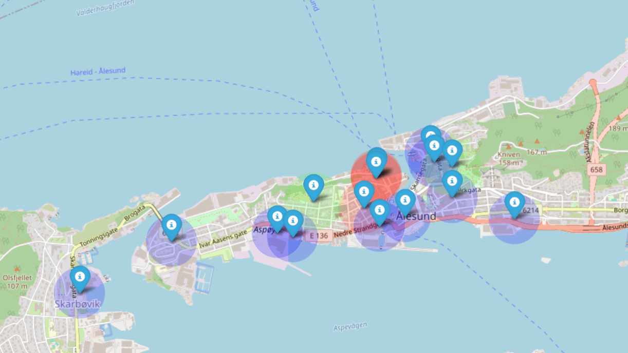
Liveability map
The Walkability Score Map permits users to assess walkability of an area based on individual preferences. A spatial multi-criteria model is used compute and visualize walkability scores for road links in a map-based view. The prototype demonstrates walkability for Ålesund city in Norway.
The Liveability map visualizes the type, location and distance to various urban qualities. Users define which elements to view, such as services, amenities and other urban qualities. The tool also permits defined a distance range to each quality, which supports the consideration the spatial distribution of selected qualities, and the density in a given area.
Dissemination
The datasets being used for walkability computation can be found at
More details regarding the datasets and the walkability computation procedures can be found in the following outcomes:
- Leplat, L. Generic Platforms for Indicator Visualization in City Planning
Norwegian University of Science and Technology (NTNU), Norwegian University of Science and Technology (NTNU), 2022, https://ntnuopen.ntnu.no/ntnu-xmlui/handle/11250/3015570
- Leplat, L.; da Silva Torres, R.; Aspen, D. & Amundsen, A.
GENOR: A Generic Platform for Indicator Assessment in City Planning
36th International Conference on Modelling and Simulation (ECMS), 2022, 245-253, http://doi.org/10.7148/2022
- Longva, B. Digital Twin for Walkability Assessment in City Planning
Norwegian University of Science and Technology (NTNU), Norwegian University of Science and Technology (NTNU), 2021, https://ntnuopen.ntnu.no/ntnu-xmlui/handle/11250/2788534
- Hu, Z. Encoding and Visualizing Temporal Changes of Topology Density Maps
Norwegian University of Science and Technology (NTNU), Norwegian University of Science and Technology (NTNU), 2022 https://ntnuopen.ntnu.no/ntnu-xmlui/handle/11250/3015569
- Leplat, L.; da Silva Torres, R.; Aspen, D. & Amundsen, A.
VIZPLAN: A Visual Analytics Platform for the assessment of multidimensional indicators over time
7th Smart Data and Smart Cities (SDSC) Conference, 2022, https://doi.org/10.5194/isprs-annals-X-4-W3-2022-127-2022